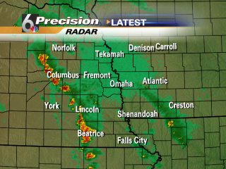
Have you noticed how difficult it is to see the detail of the precipitation on KMTV's radar? Why do they use a green background? You'd think they would want the green radar returns to show up better.
As for Channel 6 and their "Precision Doppler 6000"... it is anything but! Only 42/15 has a less precise radar.
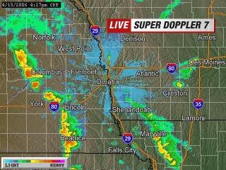
Channel 7 has the best radar with the most detailed background mapping. Looks like Google's satellite pictures.
2 comments:
Have you noticed how difficult it is to see the detail of the precipitation on KMTV's radar? Why do they use a green background? You'd think they would want the green radar returns to show up better.
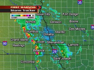
As for Channel 6 and their "Precision Doppler 6000"... it is anything but! Only 42/15 has a less precise radar.
Channel 7 has the best radar with the most detailed background mapping. Looks like Google's satellite pictures.
wait till you see KPTM's radar coming soon. In the next two weeks i think. But it supposed to be as good as KETV's
Post a Comment