The National Weather Service office in Valley, Neb., issued the following statement Friday at 10:15 p.m.:
Saturday: Windy. Not as warm. Partly cloudy with a chance of thunderstorms in the morning. Then thunderstorms likely in the afternoon. Some thunderstorms may be severe with large hail and damaging winds in the afternoon. Saturday night, breezy. Thunderstorms likely in the evening. Some thunderstorms may be severe with large hail and damaging winds.
The Omaha World-Herald newspaper, which contracts with AccuWeather, Inc., to provide its forecasts, did not publish a weather-specific story in its Saturday editions (which go to press after midnight).
However, on the weather page within the Midlands section, the following forecast appears:
Southeast Nebraska: Turning windy and warm today with some strong to severe thunderstorms.
Meteorologists from Omaha’s five TV stations weighed in with their forecasts on Friday late evening newscasts. Here are capsule looks at what they said:
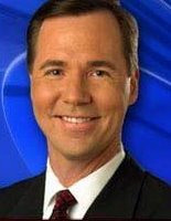
Dean Wysocki
Meteorologist, KMTV (Cox Channel 5)
 Wysocki, subbing for Chief Meteorologist Ryan McPike, said the latest computer guidance pointed toward a severe weather event.
“It looks like mid to late afternoon it should start off to our south and west and then spread toward the metro,” he said. “Once it gets here, it’s going to pack quite a punch.”
Jim Flowers
Chief Meteorologist, WOWT (Cox Channel 8)
 Flowers pointed out that he had adjusted his forecast in terms of the timing of the arrival of severe weather.
“Some showers or maybe even a thundershowers may (develop) around noon,” he said. “But this is not the severe weather event we are talking about.
“The squal line lifts to about Omaha up toward Tekamah, this would be probably between about nine and 10 o’clock if this current timing holds true. Then that squal line would lift on to Western Iowa. The main threat tomorrow would be hail and high winds. You can’t rule out a few tornadoes out west during the initial spinoff that would occur during the afternoon along that dry line.”
Bill Randby
Chief Meterologist, KETV (Cox Channel 9)
 “We are, according to the Storm Prediction Center, in the area that is ripe for severe thunderstorms and maybe tornadoes,” Randby said.
"I do expect storms to occur, we may get a shower early but the real risk of severe weather is from 4 p.m. on into the evening.”
Randby also made a point of encouraging viewers to “stay tuned to KETV” through Saturday afternoon for the latest weather information.
Elizabeth Merriman
Meteorologist, KPTM/KXVO (Cox Channels 10/11)
 Merriman, subbing for Chief Meteorologist Tyson Pearsall, pointed out that the Omaha metropolitan area was in the “moderate risk” area, according to the Storm Prediction Center.
“Thunderstorms are likely to erupt in the area after four o’clock,” she said. “Most likely (those) things are going to be large hail and damaging winds.”
No comments:
Post a Comment